New Publication in Open Quaternary
The latest results of DISPERSE research in the Kenya Rift have just been published in Open Quaternary
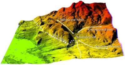
Published as Edaphic and topographic constraints on exploitation of the central Kenya Rift by large mammals and early hominins, available here and at http://dx.doi.org/10.5334/oq.21, this paper sets out the methods that we are developing to reconstruct older topography in tectonically active settings, taking advantage of digital elevation data, satellite imagery and measurements of soil-edaphics, and applies these methods to the interpretation of large-mammal distributions in the Central Kenya Rift and the interpretation of the 1-million-year old Acheulean site of Kariandusi.
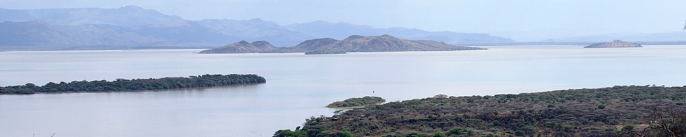
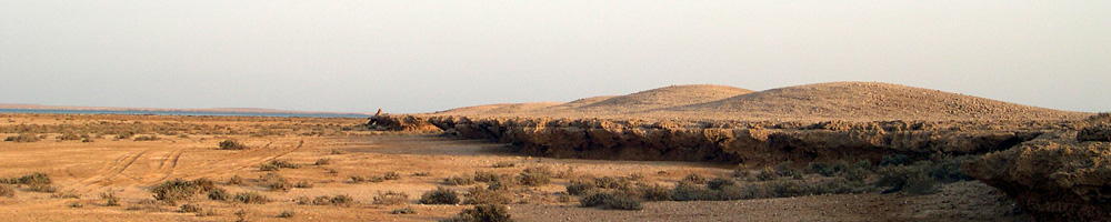
We use these sources of information to create a palaeoenvironmental and spatio-temporal framework for interpreting human land use and exploitation of large mammals in the Central Kenya Rift over the past 2 million years, with particular reference to the Nakuru-Elmenteita-Naivasha basin and its adjacent rift flanks on the Kinangop Plateau and Mau escarpment. We pay particular attention to the tectonic and volcanic history of the region, and to the system of lakes that have undergone periodic expansion and contraction during the Pleistocene in response to climatic and tectonic controls. We use this information to reconstruct topographic features as they would have existed at different periods of the past and their likely influence on patterns of large-mammal movements. In addition we present a systematic mapping of variations in the mineral nutrients of soils – soil edaphics – based on 150 analyses of trace elements in modern soil and vegetation samples. Soil edaphics play an important role in animal and human health today, with serious deficiencies in some areas, and would have exerted an important constraint on animal distributions and movements in the past. We show how soil-edaphic properties vary across the region and demonstrate a close relationship between them and the underlying geology and sediments, which allows us to project patterns back into the past and extrapolate them over larger areas. Using this combination of variables, we construct maps that help to place archaeological sites into their wider regional setting. We focus in particular on the Acheulean site of Kariandusi and show that it occupied a unique window of opportunity in place and time for trapping mammals constrained to move through a narrowly defined topographic bottleneck between edaphically-rich areas. We infer that the site was used for a simple form of ambush hunting and briefly explore the implications for differential site use, formation, preservation and visibility.