
Farasan Shell Mounds
One of the themes of the DISPERSE project is investigating the Holocene coastal archaeology of the Farasan Islands. Numerous shell mounds are present on the Islands, dating back to about 6000 years ago. They are associated with a rapidly changing littoral environment and provide a high resolution case study of how coastal populations adjusted to dynamic coastline changes and the nature of the resulting archaeological record.

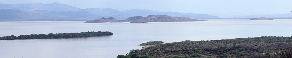
The purpose of the research is to characterise the archaeological signature of an intensive marine economy, the factors that lie behind the accumulation of the shell mounds, which are today the most visible and abundant traces of prehistoric settlement on the Islands, their relationship to dynamic changes in coastal geomorphology and ecology, and the ways in which they can help to identify and intepret earlier traces of coastal archaeology in the Pleistocene, especially in the search for underwater remains associated with periods of lower sea level. The focus is the abundant and highly visible shell mounds, which range in size from scatters of shells, to mounds over 5m in height or hundreds of metres in length (Figure 1)..
Shell mounds were first identified on the islands as part of the Comprehensive Archaeological Survey Program for Saudi Arabia in the 1970s. However their quantity and significance was not known at this time. Later researchers often referred to the sites as “shell banks”, assuming that they had a natural rather than anthropogenic origin.
In 2006 the first systematic field survey of the shell mounds was undertaken (Bailey et al. 2007) , with over 1000 shell mound deposits identified and test pits excavated into two of the mounds demonstrating anthropogenic origins (Figure 2). The number of recorded sites has now risen to over 3000, many of them substantial mounds.These sites therefore represent one of the largest concentrations of shell midden sites in the world, and one of the least damaged by either coastal processes or modern and historic modification.

Further seasons were conducted in 2008 and 2009. Survey methods included remote sensing, site identification and landscape reconstruction, bringing the number of known shell midden sites on the Farasan Islands to 3000 (Bailey et al. 2013). Two shell midden sites were excavated, and 40 test pitted, with marine and terrestrial vertebrate food remains, artefacts, and of course shells, present in the sites. However these investigations raised more questions, such as how long was the period of shell midden formation? Was it continuous or episodic? Was it seasonal or continuous? How rapidly did the mounds accumulate? What is the relationship between different mounds? What is the relationship between the accumulation of the mounds and the environment?
Research undertaken as part of the DISPERSE Project has built on this research over four field seasons, with the excavation of an additional 18 shell middens, completion of detailed survey measurements of the other middens, and a comprehensive programme of column sampling, radiocarbon dating and shell analysis, which is ongoing.
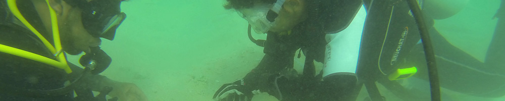
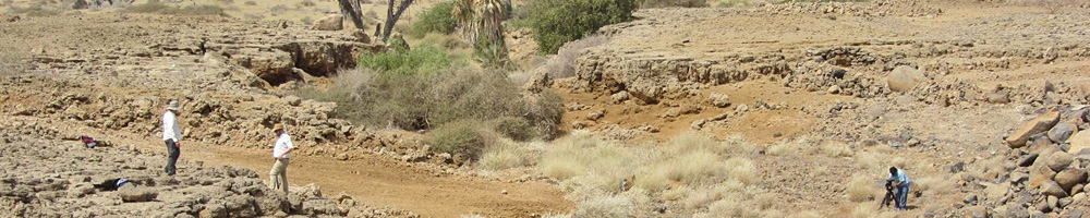
The research has included the development of predictive models for identifying where shell mounds are likely to accumulate, and these models together with satellite imagery have been used to identify a further 1200 potential sites elsewhere in the southern Red Sea, including the Dahlak Islands of Eritrea (Meredith-Williams et al. 2014). They are also helping in the task of identifying where to look for underwater traces of archaeological activity on sumerged shoreelines formed at periods of lower sea level. Today these islands are 35–40 km offshore of the mainland, but they would have been attached to the mainland when sea level was lower than about 50m. Isolated finds of Middle Stone Age artefacts suggest ocasional visits in these earlier periods, but for most of the time the Islands would have represented low hills in a more or less extensive coastal landscape with palaeoshorelines at variable distances from the present-day coastline, and at varying depths. Preliminary diving work in 2006, and more recently, has established the presence of identifiable underwater shorelines, and this work is being developed with new diving work and more extensive remote-sensing to identify and map palaeoshorelines and other features over a larger area as part of the DISPERSE project.
Forthcoming DISPERSE publications will focus on reconstructing the nature of shell mound accumulation and the types of behaviour associated with these activities.
At present we know that shellfish was processed at certain locations, often repeatedly. The predominant target prey species varied both within shell mounds, and between shell mounds. This could demonstrate either responses to changes in the environment, or changing social preference over time; work is on-going to refine this.
Of the 3000 sites found on the islands, the majority are located inland on palaeoshorelines; the same is true for the further 1400 shell midden sites located elsewhere in the southern Red Sea, and for the 20 sites already known in the published literature. This demonstrates that the coastlines of the islands (and the southern Red Sea) are dynamic, and have experienced change since the mid-Holocene. It seems likely that extensive shell beds appeared rapildy and then disappeared again, meaning that people were probably exploiting relatively short-lived windows of ecological opportunity that allowed them to gather shellfish in such abundance.

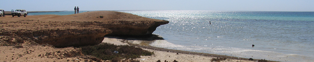
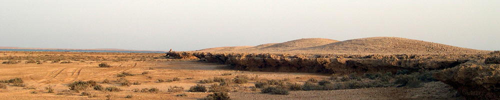
A small minority of shell midden sites are located on present shorelines, notably the site of JE0004 in Janaba Bay, excavated over a number of seasons. It is likely that the offshore topography has played a role here, with the height of the cliff on which the site is located, and the depth of subtidal water below the cliff, minimising the impact of minor sea-level change during the Holocene. In other areas, both on the islands and the mainland, relative sea level change and geomorphological processes including tectonics associated with salt doming have resulted in palaeoshorelines being located inland from the modern day shoreline (Figure 3).
Most sites are located directly on the palaeoshoreline. However there are a minority that are located up to 500 m inland of their contemporaneous shoreline. DISPERSE research is targeting these to determine why this is the case, and to investigate whether they are the result of different activities, or different periods of shell midden accumulation.
In most cases shell has been deposited directly on the palaeoshoreline, with ethnographic research suggesting that this is due to the limiting weight of the shellfish. Shell is often brought back to a central location where it can be prepared, before either being consumed directly, or taken further afield. In some cases the shellfish is used for purposes other than consumption, such as bait, for trade, or even as building materials. Given the presence of fish bone in some of our excavated samples, and occasional bones of terrestrial mammals including gazelle, it is likely that the Farasan Islands sites were processing sites for subsistence activities.
The aspect of seasonality is currently being explored through DISPERSE research into the stable isotope and chemical composition of the shells. We know that stone artefacts, which are rare, were made on raw material that can only be found on the mainland. This suggests that there were at least contacts between the islands and the mainland, and that it is even possible that people from the mainland made regular trips to the Islands on a seasonal basis for fishing and shellgathering. Evidence for other activities on the Islands dating to the mid-Holocene is currently limited.
References
- Bailey, G.N, AlSharekh, A., Flemming N., Lambeck, K., Momber, G., Sinclair, A., Vita-Finzi, C. 2007. Coastal prehistory in the southern Red Sea Basin: underwater archaeology and the Farasan Islands. Proceedings of the Seminar for Arabian Studies 37: 1–16.
- Bailey, G.N., Meredith-Williams, M.G., Alsharekh, A.M. 2013. Shell mounds of the Farasan Islands, Saudi Arabia. In G.N. Bailey, K. Hardy, A. Camara (eds) Shell Energy: Mollusc Shells as Coastal Resources. Oxford: OxBow, pp. 241–54.
- Williams, M.G.M. 2010. Shell mounds of the Farasan Islands, Saudi Arabia. Proceedings of the Seminar for Arabian Studies 40: 357–366.
- Meredith-Williams, M., Hausmann, N., Inglis, R., Bailey, G.N. 2014. 4200 New Shell Mound Sites in the Southern Red Sea 'Human Exploitation of Aquatic Landscapes' special issue (ed. Ricardo Fernandes and John Meadows), Internet Archaeology 37, doi:10.11141/ia.37.2.