Tectonic Landscapes: Africa and the Levant
Reconstructing the physical landscape at local, regional and continental scales of observation is central to an understanding of how factors of topography and geomorphology change over time, how they affect the resources available for human exploitation, how they mediate the impact of climate change, and how this combination of environmental factors shapes patterns of hominin land use, mobility and dispersal. Since most landscapes have undergone geomorphological changes over the time span of human evolutionary history in response to a variety of processes, understanding what drives the evolution of the physical landscape is a theme of major importance.
Underlying tectonic processes of earth deformation are a major determinant. These processes operate over a wide range of geographical and temporal scales, ranging from large-scale deformation associated with plate tectonics to localised and short-lived episodes such as earthquakes, or volcanic eruptions that may be more or less short lived with consequences ranging from the local to the global. A perspective that combines these different scales of analysis, and can place local features into the bigger picture, is therefore essential, even when studying localised environments surrounding individual sites of archaeological or fossil material (King and Bailey, 2006, Bailey et al., 2011; and other references therein).

We have articulated the hypothesis, variously known as the Tectonic Landscape Model (Reynolds et al., 2011) or the Complex Topography Hypothesis (Winder et al., 2013), that the complex topography resulting from very dynamic and tectonically active landscapes is a potentially powerful selective agent in the early human evolutionary trajectory. Further development and testing of these ideas is a prime objective of DISPERSE.
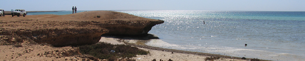
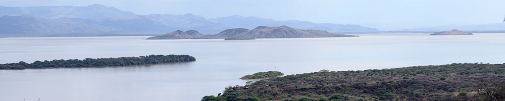
In our investigations we place particular importance on the ways in which tectonic effects such as faulting and lava flows alter or sustain topographic features. Many of these processes are destructive, but they can also have beneficial effects. For example, repeating earthquakes on fault zones can create and accentuate basins that trap water and sediment, and activate or re-activate spring lines, concentrating and renewing local or regional conditions of fertility and water supply (Figure 1). They also create a complex topography of barriers, bottlenecks and enclosures of varying size that afford tactical advantage in pursuit of prey or escape from predators. Volcanic lava flows can have similar effects in trapping sediments, renewing soil nutrients and creating minor barriers.

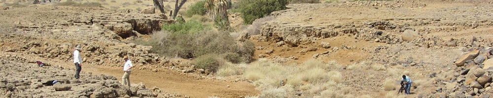
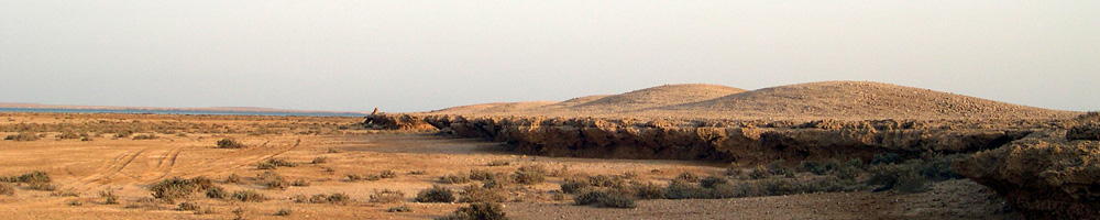
Because of the complex interplay between these dynamic processes, the varying rates at which they operate, and the varying degree and duration of landscape stability or instability, research requires a combination of different approaches. These include extensive use of satellite imagery and digital elevation models, field observations, dating of land forms such as lava flows, fault scarps and sediment fills, and modelling of fault motions (Figure 2).

Through this combination of approaches, it should prove possible to ‘wind back the clock’ of tectonic change, and so to visualise the physical features of the landscape as they might have existed at some earlier time.
We are also interested in those features that do not change over time in a dynamic landscape, and are therefore features which can be projected back in time as constant points of reference. The balance between long-term stability and change varies in different regions depending on the nature of the regional tectonics.
One feature that we are exploring is the differing edaphic properties of soils formed on different types of substrates, such as lava flows, sedimentary rocks, Quaternary sediments, and so on. Edaphics refers to the capacity of the soil to provide the mineral nutrients essential for animal growth and health. Along with tectonically created topographic barriers, this appears to be a major controlling factor on the concentration and movements of herbivorous mammals (Figure 3), and to show a strong correlation with the mineral properties of the underlying bedrock or substrate (Devès et al., 2014). We are carrying out studies of modern animals in Kenya as well as research on the relationship between the faunal remains found on archaeological sites and the features of their contemporaneous landscape to pursue this hypothesis further.
References
- Bailey, G.N., Reynolds, S.C, King, G.C.P. 2011. Landscapes of human evolution: models and methods of tectonic geomorphology and the reconstruction of hominin landscapes. Journal of Human Evolution 60 (3): 257–80, 2011.
- Devès, M.H., Sturdy, D.A., King, G.C.P., Godet, N., Bailey, G.N. 2014. Hominin reactions to herbivore distribution in the Lower Palaeolithic of the southern Levant. Quaternary Science Reviews 96: 140–160. DOI: 10.1016/j.quascirev.2014.04.017. 15 July 2014.
- King, G.C.P., Bailey, G.N. Tectonics and Human Evolution. 2006. Antiquity 80: 265–86.
- Reynolds, S.C., Bailey, G.N., King, G.C.P. 2011. Landscapes and their relation to hominin habitats: case studies from Australopithecus sites in eastern and southern Africa. Journal of Human Evolution 60 (3): 281–98, 2011.