
Underwater Research
Introduction
Sea levels have been lower than the present for most of human existence on the Earth, about 95% of the time, typically at depths of –40m, and for shorter periods at depths of –100m or more. Extensive areas of the continental shelf were exposed during these periods, providing a variety of landscapes and environmental conditions, many of them attractive for human settlement. All of these, along with their associated coastlines and archaeological evidence became progressively inundated when the climate warmed and sea level rose at the end of the last glacial period.
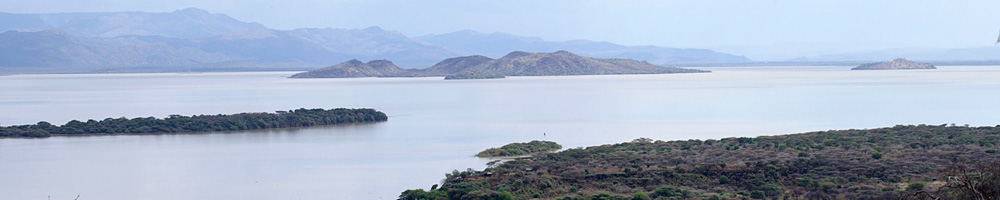
The maritime component of the DISPERSE project aims to gather data from the submerged landscapes to assess areas with the potential for human occupation, and to identify the possibility for preservation of archaeological material, especially around the Farasan Islands in the southern Red Sea. The current phase of research builds on earlier work carried out between 2006 and 2009 with experimental deep and shallow diving to identify features of the submerged landscape in the region (Bailey et al., 2007a, 2007b; Alsharekh and Bailey, 2014). The new programme is aimed at building on this earlier work through collection of palaeo-environmental and topographical data obtained from geophysical survey and coring, and renewed diving. An understanding of the geomorphological processes that have impacted the coastal strip will be derived from geotechnical data and diving operations. Diving surveys will be conducted to visually inspect sites on the seabed to characterise differing morphologies. Detailed survey, sampling and evaluation excavations will be conducted in the areas of highest potential for human occupation and with the greatest probability for preservation of archaeological material.
The work is pioneering and speculative. Human migration from Africa to Arabia has been inferred from the distribution of lithic tools and patterns of DNA variation in modern populations. It occurred at times when the palaeo-coastline was less arid than today. The remains of human activity have been found on the Farasan Islands and along the adjacent Saudi Arabian coastline. A strong expectation exists that similar, if not richer, sources of evidence will be found underwater. The discovery of such data would cast significant new light on the first waves of people to leave Africa.
Investigating the submerged landscape
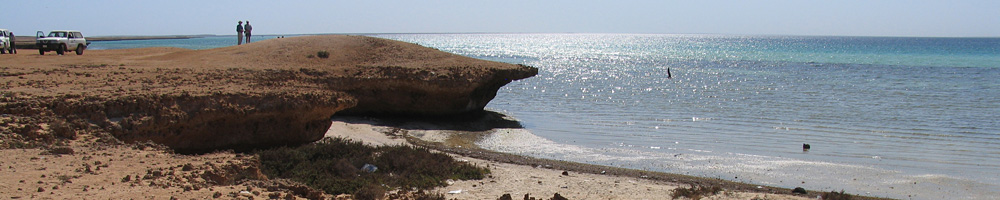
The Farasan Islands have been subject to varying degrees of tectonic activity as a result of rising salt dome migration and collapse. The results are evidenced by warping of the landscape and deep circular depressions now hundreds of metres below the water. ") Despite the dramatic changes to the submerged landscape which occurred on the longer geological timescale, it is believed that land movements have been relatively minor in the shorter human timescale. Laterally consistent incised wave cut and solution notches along the coastline with sizable overhangs suggest periods of land/sea stability during the last 5,000 years. In addition, coral terraces which formed below water are now at an average height of 4–5m above sea level albeit that some elevations reach to over 10m. This position compares favourably with the elevated global ocean levels during the OIS 5 high stand suggesting that, on the whole, there has been limited vertical movement over the last 100,000 years. Notwithstanding localised salt tectonic warping, it appears land movements have been modest.
Despite the dramatic changes to the submerged landscape which occurred on the longer geological timescale, it is believed that land movements have been relatively minor in the shorter human timescale. Laterally consistent incised wave cut and solution notches along the coastline with sizable overhangs suggest periods of land/sea stability during the last 5,000 years. In addition, coral terraces which formed below water are now at an average height of 4–5m above sea level albeit that some elevations reach to over 10m. This position compares favourably with the elevated global ocean levels during the OIS 5 high stand suggesting that, on the whole, there has been limited vertical movement over the last 100,000 years. Notwithstanding localised salt tectonic warping, it appears land movements have been modest.
Geophysical and acoustic survey conducted by the Hellenic Centre for Marine Research (HCMR) in June 2013 looked to qualify the underlying processes (Fig 1). Multibeam and sidescan sonar surveys were conducted to characterise the bathymetry and seabed morphology while boomer and pinger sub-bottom profiles were employed to record the underlying geological controls. This work was conducted in deep water in excess of 60m. The results are being processed and they will help inform the strategy for deep water diving. However, the initial assessment shows a landscape of complex topography dating back into the Pleistocene with indications of fluvial channels cutting the palaeo-landscape (Fig 2.).

")
Wave and solution cut features
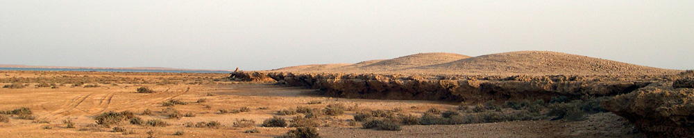
Due to the relatively stable isostatic conditions since OIS5 around large parts of the archipelago, eustatic still stands during the last transgression and recession have etched notches into submerged cliff faces and promontories similar to those seen in Figure 3. Such features were recorded underwater during the 2006, 2008, 2009 and 2014 projects. Where the depths of these notches were seen to correspond with periods of sea level stasis, correlations have been made between the current depths and sea level fluctuation curves. Where the current depth of the wave cut features implies formation before the last transgression, such a notch or overhang would have existed in the terrestrial landscape when the sea level was lower. The shelter afforded by these features would have provided shade and acted as attractive locations for human activity. This being the case, there exists the possibility that archaeological material may have been dropped or deposited at these sites. One of the tasks in the 2014 field season was to collect more bulk samples from below the cave on West Qumah to search for archaeological evidence of human activity.
Submerged midden activity sites
The coral terraces around many of the bays and inlets of the Farasan coastline are crowned with shell middens. These are known to date back almost 7,000 years. They have been built up over long periods and began forming at a time when sea levels were lower.
It is possible that middens were created on coastal surfaces that have now become inundated. Therefore in 2009 work was conducted to investigate the near shore sub-littoral zone in the Sulayn archipelago to look for material that might have survived the final stages of the last transgression. This was continued in 2014. The area targeted had bathymetric characteristics that were comparable to the topography of the current coastline where there was widespread development of middens.
2014 Fieldwork
.") The two dive sites investigated during the most recent underwater fieldwork were Sulayn and Qumah Bay. The methodology developed at Sulayn focussed on sampling spatially and horizontally within the sediment matrix across a well defined area. Excavations to the underlying bedrock were conducted in selected areas to show any variations in colouration and taphonomy, but primarily to find evidence of human activity such as charcoal. The samples showed a top layer of sandy sediment, a lower layer of shells, another lower layer of coral and a hard basal, coral terrace. Organic inclusions were recorded at various locations around the sand and shell interface. An airlift was used to remove overburden and collect samples from gullies within the coral basement rocks.
The two dive sites investigated during the most recent underwater fieldwork were Sulayn and Qumah Bay. The methodology developed at Sulayn focussed on sampling spatially and horizontally within the sediment matrix across a well defined area. Excavations to the underlying bedrock were conducted in selected areas to show any variations in colouration and taphonomy, but primarily to find evidence of human activity such as charcoal. The samples showed a top layer of sandy sediment, a lower layer of shells, another lower layer of coral and a hard basal, coral terrace. Organic inclusions were recorded at various locations around the sand and shell interface. An airlift was used to remove overburden and collect samples from gullies within the coral basement rocks.
In the deeper water, to the east of the surveyed area, the sediment cover of sand and shell was thinner but the coral above the basement/bedrock was thicker. Five metres upslope towards the west, the covering sediment was thicker but the concentration of coal immediately above the bedrock was thinner. On the northerm baseline, dark grey ‘stains’ were recorded at 5 and 6m. These ‘stains’ extended below heads of coral that must have grown after the marks were formed. It is possible that these ‘stains’ were formed when the sea level was dry land. Samples of the seabed surface were collected for analysis. There were not any similar features recorded in the 3m by 1m trench opened to the seabed in the east.
At Qumah, a similar method was developed, where samples were collected from along a trench. The trench was excavated with mattocks and the airlift (Fig. 4). The sand cover was thin on the slope in front of the cave and the underlying bedrock was exposed beneath 20-30cm, 1.5 to 7m from the cave entrance. However, immediately in front of the cave, the sediment was thicker. Here, the samples collected from 30-50cm below the surface contained a mixture of shells and an incongruous lithic.
") From the work that has been done on the survey and excavation of shell mounds and other archaeological sites formed within the last 7000 years on the modern shoreline, lithic artefacts are relatively rare, with much of the technology based either on shell or other organic materials. This means that the likelihood of finding lithic artefacts as markers of cultural activity on submerged land surfaces is lower than would otherwise be the case. The main indicator of cultural activity under water, as on the modern land surface, is likely to be shells discarded as food remains. In the underwater setting, this poses the additional challenge of discriminating between shell material deposited as natural death assemblages from shell material discarded as cultural food remains. A large number of bulk samples were recovered from underwater excavation to provide material for such an analysis (Fig. 5). Some of these samples underwent preliminary sorting in the field, and smaller subsamples have been returned to the laboratories at the University of York for more detailed analysis.
From the work that has been done on the survey and excavation of shell mounds and other archaeological sites formed within the last 7000 years on the modern shoreline, lithic artefacts are relatively rare, with much of the technology based either on shell or other organic materials. This means that the likelihood of finding lithic artefacts as markers of cultural activity on submerged land surfaces is lower than would otherwise be the case. The main indicator of cultural activity under water, as on the modern land surface, is likely to be shells discarded as food remains. In the underwater setting, this poses the additional challenge of discriminating between shell material deposited as natural death assemblages from shell material discarded as cultural food remains. A large number of bulk samples were recovered from underwater excavation to provide material for such an analysis (Fig. 5). Some of these samples underwent preliminary sorting in the field, and smaller subsamples have been returned to the laboratories at the University of York for more detailed analysis.
.")
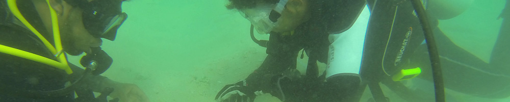
At the conclusion of the fieldwork, the dive team (Fig. 6) had conducted 9 days’ diving with 2 days spent surveying shell middens on land to gain a comparative perspective. Twelve divers from the UK and Saudi Arabia took part in the work, trained together and learnt from each other. Eleven supporting team members were in the diving operations, including three members of the Saudi Border Guard and two boat crew from the Farasan Municipality. Six different boats were involved. In total there were 94 dives in 64 diving operations, and 102 samples were recovered for sieving and assessment. The fieldwork was carried out with the collaboration and support of the Saudi Commission for Tourism and Antiquities, the Farasan Border Guard, the Farasan Municipality and the Governor of Farasan, with additional financial support from the National Geographic Society. We are indebted to all the individuals who assisted with our work in Farasan: Hussain Aldajani (Governor), Captain Faisal Al Johany (Saudi Border Guard) and Abdulaziz Al Sha’bi (Farasan Municipality). Above all, we thank our sponsors in the Saudi Commission for Tourism and Antiquities: Prince Sultan bin Salman (President), Dr Ali Al Ghabban (Vice President), Jamal Omar (Director General), and Rostom Kubaisi (Director in Jizan).