Saudi Arabia Palaeolithic Survey
The archaeological record of the Arabian Peninsula is central to narratives of hominin dispersals from Africa to the rest of the globe during the Palaeolithic, with a time depth of at least 1 million years, yet its potential has only recently begun to be realised. The Southwest region of the Arabian escarpment is of particular interest as one of the most persistently well-watered and fertile regions of Arabia, easily accessible from Eritrea and Ethiopia across a very narrow sea channel interspersed with small islands for long periods of the Pleistocene. It is also adjacent to a highly productive marine environment, and has a long record of Palaeolithic occupation first revealed by the work of the Comprehensive Archaeological Survey Programme in the 1970s (Zarins et al. 1980; 1981).
The objectives of research on this theme are to expand knowledge of the Palaeolithic and palaeoenvironmental record of the region through survey, and excavation where appropriate, and to examine the relationship between the distribution in space and time of the archaeological material and the wider geological and geomorphological history of the region. Different Homo species may have used the landscape in different ways, targeting different landscape features during different dispersals. Understanding human-landscape interactions is therefore crucial to understanding the ways in which these species were able to disperse across the globe.

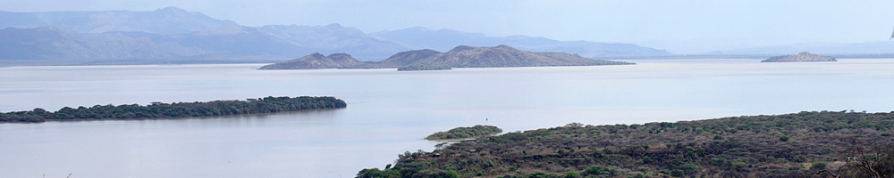
In some respects, the Red Sea region represents a northward extension of the East African Rift. It has undergone successive episodes of tectonic deformation and magmatism, and has many similar landscape features to those encountered in Africa. In addition it has a coastline that has been subjected to Pleistocene sea-level change, resulting in periodic exposure and subsequent flooding of an extensive and now submerged coastal lowland, which would have extended for as much as 100 km offshore of the present coastline (Figure 1).
All these factors make SW Saudi Arabia an ideal laboratory to test models of landscape use by hominin populations in a key region for dispersals out of Africa. It is a prime target for the DISPERSE project, and landscape reconstruction and more detailed survey and investigation of the Palaeolithic record, particularly in the Jizan and Asir provinces, are a major theme of the project.

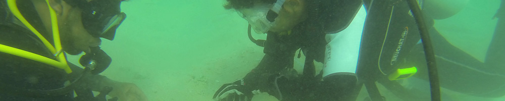
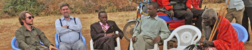
Research is being conducted in collaboration with the Saudi Commission for Tourism and Antiquities, King Saud University (Abdullah Alsharekh and Saud Al Ghamdi), and the University of Liverpool (Anthony Sinclair). The work is combining archaeological, geomorphological and remote sensing methods to chart the underlying geological processes that have shaped the evolution of the physical landscape and its various geomorphological transformations over time, to find new Palaeolithic sites, especially stratified material, and to examine their geographical and temporal distribution in relation to features such as water, raw material, topography and areas with access to animal prey and other resources.

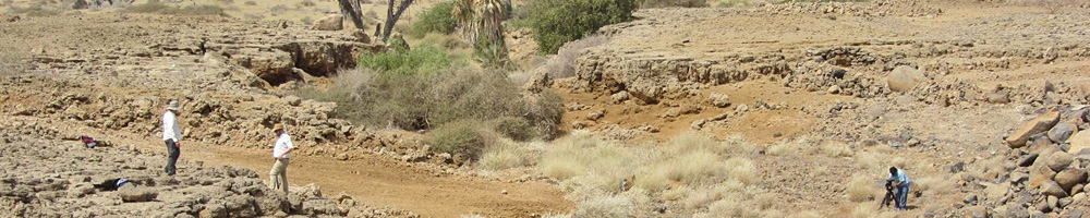
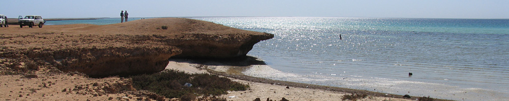
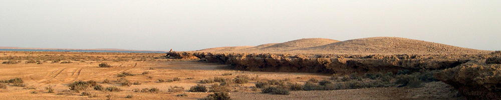
Lava flows and volcanics are of particular interest (Figure 2), as well as fossil coral terraces preserved along the coastline (Figure 3), since the discovery of Palaeolithic artefacts in the region in the 1970s was closely related to these features. We are also spreading our net more widely to consider the full range of land forms from the escarpment to the coastline, to areas where artefacts have not previously been discovered as well as those, such as areas of volcanics, where there is a high probability of discovery, and to a wide range of physical features including rock shelters, palaeo-lakes, river channels, and elevated plateaux with commanding views.

The interpretation of the surface archaeological record is not straightforward. The observed distribution of artefacts across a landscape is not a direct reflection of the behaviour of hominin populations. Instead it is a palimpsest of activity over time, with concentrations of artefacts built up over potentially hundreds of thousands of years. Added to this, geomorphological processes and the distribution of raw materials for making stone tools control the preservation and accessibility of archaeological material within a landscape, burying and destroying some parts of the record whilst preserving others. Furthermore, environmental change, underlying geophysical processes and sea level change would have radically changed some landscape features over time, altering the differential attractions of different areas at different periods.
The DISPERSE project is therefore employing a multiscalar set of analyses to investigate landscape use. Remote sensing data is utilised to characterise topography and landforms within the study region in order to target areas of high potential for surface archaeology, as well as those which preserve stratigraphy and the potential for stratified artefacts and palaeoenvironmental information, such as wadi and quarry cuts (Figure 4).
Combined archaeological and geomorphological fieldwork has been undertaken to locate and situate new archaeological data within a dynamic model of landscape evolution. This data can then be used to test models of landscape use by hominin populations and their implications for understanding global dispersals.

Over the lifetime of the project, a series of fieldwork campaigns are planned, beginning with broad-scale characterisations of the landscape and assessments of the potential for the location of both surface and stratified lithic material, and progressing to more detailed site survey, with excavation where appropriate. To date, DISPERSE has undertaken four seasons of fieldwork: brief reconnaissance visits in May–June 2012 (Devès et al., 2012; 2013), and November 2012 (Bailey et al., 2012), and two full seasons of combined archaeological and geomorphological survey in (Inglis et al. 2013, 2014b) and January-March 2014 (Inglis et al. 2014a).
We have visited over 90 new localities in a range of landscape settings, from lava flows to alluvial sediments exposed in quarry sections, as well as fossilised coral beach deposits on the coast. Most localities yielded Palaeolithic artefacts, and in total over 1400 Early, Middle and Later Stone Age artefacts have been recovered and analysed (Figures 5 and 6). Three localities contained artefact-bearing stratigraphy, including one locality where 19 Middle Stone Age artefacts were embedded within deposits underlying fossil beach material (Figures 7 and 8). Work is currently underway in collaboration with the Scottish Universities Environmental Research Centre (SUERC) and the Saudi Geological Survey (SGS) to date these sites. Analysis of the distributions of surface artefacts, and their implications for hominin landscape use is ongoing. Additional fieldwork will take place during the lifetime of the project.


References
- Bailey, G.N., Inglis, R.H., Meredith-Williams, M.G., Hausmann, N., Alsharekh, A.M., and Al Ghamdi, S. (2012). Preliminary Report of Reconnaissance Fieldwork in Southwest Saudi Arabia, November–December, 2012 (PDF file - 1 MB)
- Devès, M., Inglis, R.H., Meredith-Williams, M.G., Alsharekh, A., Al Ghamdi, S., and Bailey, G.N. (2012). Preliminary Report of Reconnaissance Fieldwork in Southwest Saudi Arabia, May–June, 2012 (PDF file - 3.7 MB)
- Devès, M.H., Inglis, R.H., Meredith-Williams, M.G., Al Ghamdi, S., Alsharekh, A., and Bailey, G. (2013). Palaeolithic survey in southwest Saudi Arabia: methodology and preliminary results (PDF file - 2.3 MB). Adumatu, 27, 7–30.
- Inglis, R.H., Sinclair, A.G.M., Shuttleworth, A., Alsharekh, A.M., and Al Ghamdi, S. (2013). Preliminary Report on 2013 Fieldwork in Southwest Saudi Arabia by the DISPERSE Project: (2) Jizan and Asir Provinces Feb–March (PDF file - 2.1 MB)
- Inglis, R.H., Sinclair, A., Shuttleworth, A., Alsharekh, A., Al Ghamdi, S., Devès, M., Meredith-Williams, M.G., and Bailey, G. (2014). Investigating the Palaeolithic Landscapes and Archaeology of the Jizan and Asir Regions, Southwest Saudi Arabia. Proceedings of the Seminar for Arabian Studies, 44, 193–212.
- Inglis, R.H., Sinclair, A.G.M., Shuttleworth, A., Meredith-Williams, M.G., Hausmann, N., Budd, W., Alsharekh, A., Al Ghamdi, S., and Bailey, G. N. (2014). Preliminary Report on 2014 Fieldwork in Southwest Saudi Arabia by the DISPERSE Project: (1) Jizan and Asir Provinces (PDF file - 9.5 MB)
- Zarins, J., Whalen N.M., Ibrahim, I., Morad A, Khan, M. 1980 Comprehensive Archaeological Survey Program: preliminary report on the Central Southwestern Provinces survey. Atlal 4: 9–117.
- Zarins, J., Murad, A. & Al-Yaish, K. 1981. The Second Preliminary Report on the Southwestern Province. Atlal 5: 9–42.